Martock Neighbourhood Plan
Home - Local character - Built Environment - Conservation AreaMartock Conservation Areas |
|
|---|---|
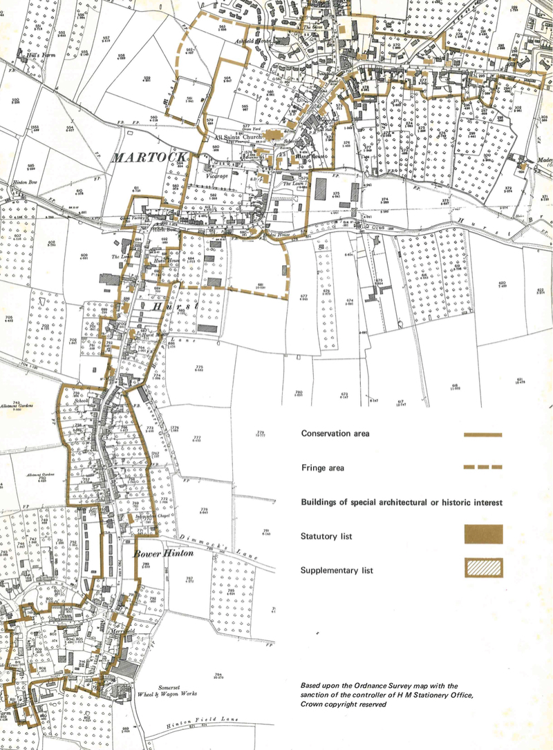
There are two conservations areas in the parish, Martock and Coat. The purpose of the conservation areas is to protect the historic street scenes in the villages. More details of this can be found in the Martock Conservation Area document produced by Somerset County Council in 1971 when the conservation areas were defined.As part of the Neighbourhood Plan programme provides an opportunity for us to review the conservation areas and redraw the boundaries if it is felt desirable. For more details follow the link on the right. The curent boundary of the Conservation are is shown below (taken from SCC document). Note that it does not include North Street which has some fine frontages and listed buildings. Should these be included? |
Conservation Area Review Our listed buildings
|
 |
|
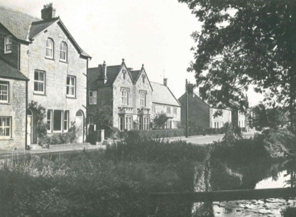
This photograph of Water Street is taken from the 1971 Conservation Area document.
|
This is the 1971 caption. This section of the street contains many fine individual buildings but the area is generally untidy and uncared for. The stream has been forgotten, except by some, who have used it to discard their unwanted possessions. If the bed of the stream were cleaned and the area landscaped with trees, seats, and the well-designed footpath, the area would be greatly improved and would become a source of pleasure for those who walk along the street. Time to review the Conservation Area Guide perhaps? |
|
|