Martock Neighbourhood Plan
Home - Housing - Built Area BoundaryThe built area boundary |
||
|---|---|---|
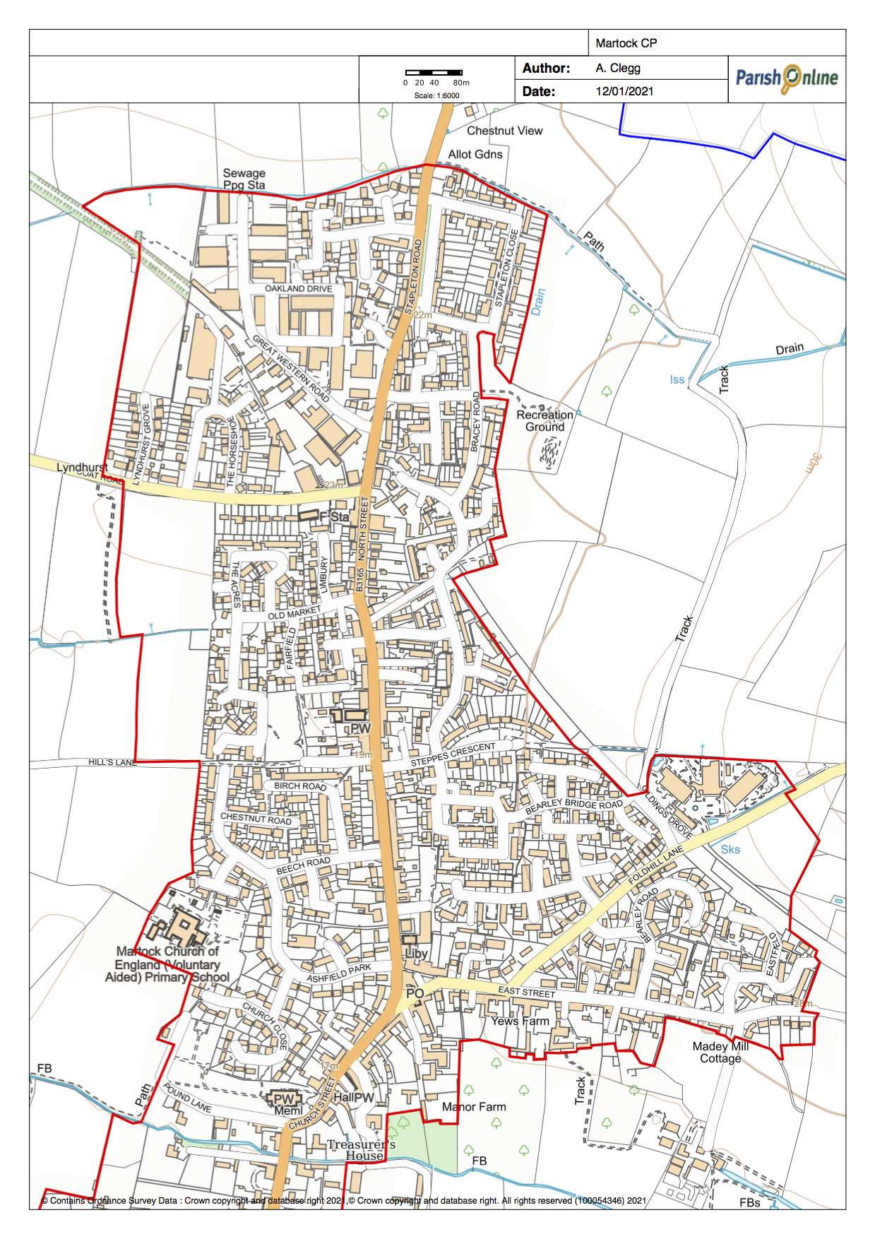
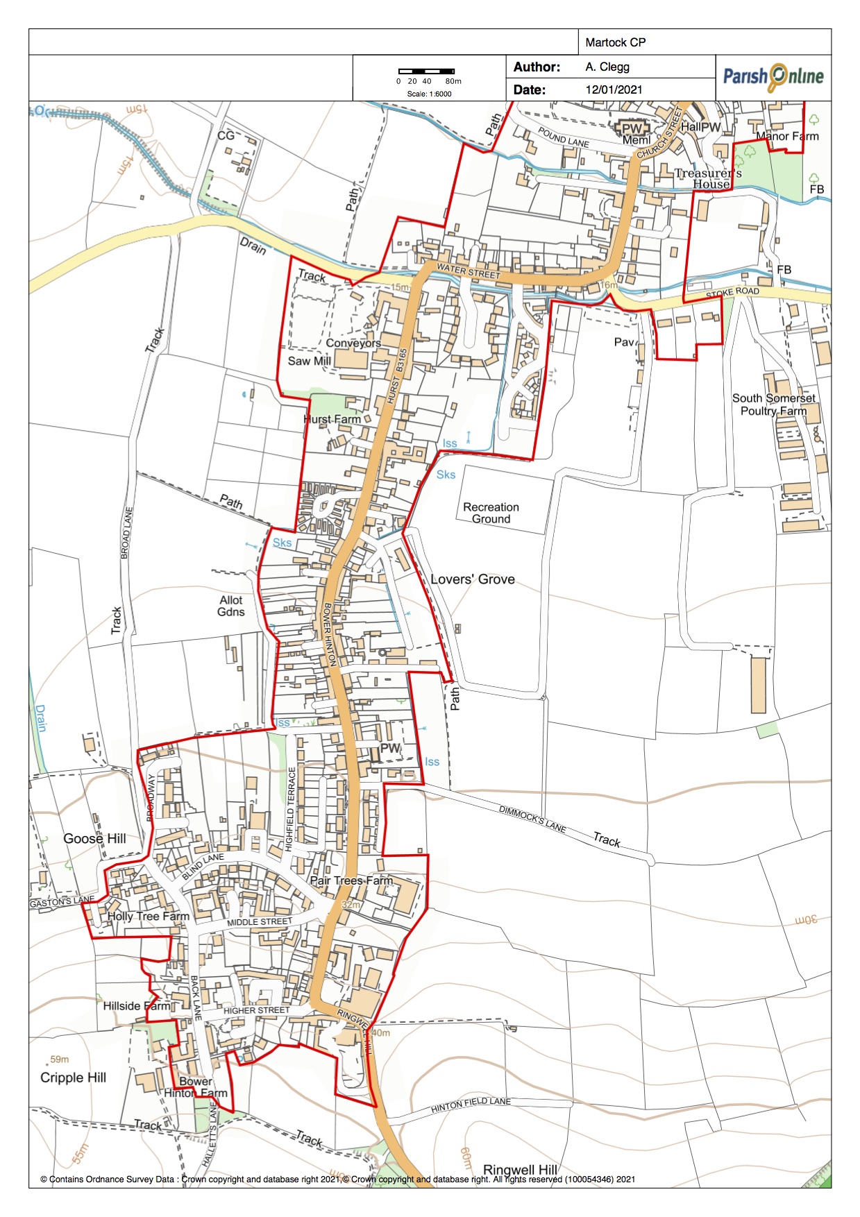
The built area (or settlement) boundary is a line (shown below in red) drawn around the existing houses and gardens in the village. It marks the current edge of the settlement. It should not be confused with the old concept of a development boundary which marks the edge of permitted development; this concept fell away with the revision of the planning laws in 2011.The boundary incoporates some areas where planning permission has been obtained but may not yet have been executed. |
A copy of this map is available here as a pdf. The criteria for drawing up the built area boundary are here |
|
The Martock built area boundary (Jan 2021) The two maps below show the built area boundary in red |
||
 |
||
 |
||