Martock Neighbourhood Plan
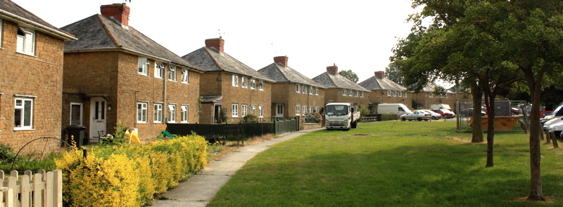 Steppes Cresecent. A public green space designed when these early council houses were built in the 1920s
Home - Local character - Natural Environment - Green SpacesGreen Spaces |
|
|---|---|
What are green spaces?Green spaces are important elements in our environment. In the Neighbourhood Plan we will identify two kinds.
|
|
Registered green spaces Registered green spaces must satisfy certain criteria, be recommended by the Parish Council and registed by the District Council. The criteria emerge from planning legislation and guidance. The following areas have been evaluated and are being proposed for registration as part of the process of producing the Heighbourhood Plan.
The Main Recreation Ground will be protected elsewhere in the Plan Landowners of the Green Spaces have been invited to comment on their registration. Anonymised comments and the response of the steering group can be seen by following the link to the right |
Criteria for registering green spaces. This link shows the criteria used and how these spaces scored. It also shows other suggestions that were rejected because they did not satisfly the criteria. Map of proposed green spaces. This shows all identified spaces in red and the ones proposed for registration in green Advice on protecting green spaces. Government advice to Neighbourhood Planners on the selection and registration of Green Spaces. Green space and green gap landowners consultation, December 2019. The representations of the owners of the green spaces and the local green gap, together with the response of the steering group, can be found here
|
Local Green Gap Following representations made during the pre-submission consultation, it was proposed to register a green gap to protect the countryside between Martock and its two northern neighbour settlements, Coat and Stapleton. The purpose of this is to maintain the separation between the settlements as Martock grows. A map of this gap can be found by following the link on the right. The owners of the land that forms this gap were consulted. Their anonymised responses can be found by following the link above right
|
|